Collaborative Mapping of Archaeological Sites Using Multiple UAVs

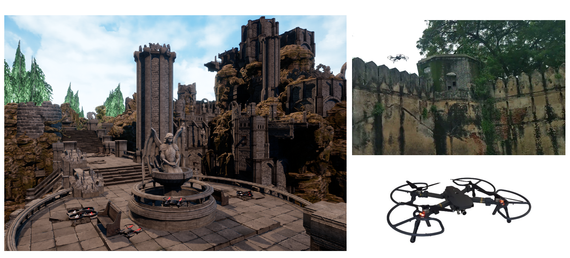
UAVs have found an important application in archaeological mapping. Majority of the existing methods employ an offline method to process the data collected from an archaeological site. They are time-consuming and computationally expensive. In this paper, we present a multi-UAV approach for faster mapping of archaeological sites. Employing a team of UAVs not only reduces the mapping time by distribution of coverage area, but also improves the map accuracy by exchange of information. Through extensive experiments in a realistic simulation (AirSim), we demonstrate the advantages of using a collaborative mapping approach. We then create the first 3D map of the Sadra Fort, a 15th Century Fort located in Gujarat, India using our proposed method. Additionally, we present two novel archaeological datasets recorded in both simulation and real-world to facilitate research on collaborative archaeological mapping. For the benefit of the community, we make the AirSim simulation environment, as well as the datasets publicly available (Project web page: http://patelmanthan.in/castle-ruins-airsim/).
| Author(s): | Manthan Patel and Aditya Bandopadhyay and Aamir Ahmad |
| Book Title: | Lecture Notes in Networks and Systems |
| Volume: | 412 |
| Pages: | 54--70 |
| Year: | 2021 |
| Publisher: | Springer International Publishing |
| BibTeX Type: | Conference Paper (inproceedings) |
| DOI: | https://doi.org/10.1007/978-3-030-95892-3_5 |
| Event Name: | Intelligent Autonomous Systems 16 |
| Electronic Archiving: | grant_archive |
| ISBN: | 978-3-030-95892-3 |
BibTeX
@inproceedings{Patel_IAS_21,
  title = {Collaborative Mapping of Archaeological Sites Using Multiple UAVs},
  booktitle = {Lecture Notes in Networks and Systems},
  abstract = {UAVs have found an important application in archaeological mapping. Majority of the existing methods employ an offline method to process the data collected from an archaeological site. They are time-consuming and computationally expensive. In this paper, we present a multi-UAV approach for faster mapping of archaeological sites. Employing a team of UAVs not only reduces the mapping time by distribution of coverage area, but also improves the map accuracy by exchange of information. Through extensive experiments in a realistic simulation (AirSim), we demonstrate the advantages of using a collaborative mapping approach. We then create the first 3D map of the Sadra Fort, a 15th Century Fort located in Gujarat, India using our proposed method. Additionally, we present two novel archaeological datasets recorded in both simulation and real-world to facilitate research on collaborative archaeological mapping. For the benefit of the community, we make the AirSim simulation environment, as well as the datasets publicly available (Project web page: http://patelmanthan.in/castle-ruins-airsim/).},
  volume = {412},
  pages = {54--70},
  publisher = {Springer International Publishing},
  year = {2021},
  author = {Patel, Manthan and Bandopadhyay, Aditya and Ahmad, Aamir},
  doi = {https://doi.org/10.1007/978-3-030-95892-3_5}
}